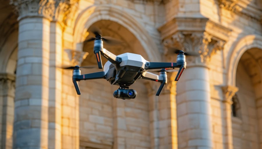
Drones equipped with high-resolution cameras are revolutionizing how stone contractors, architects, and designers capture and model building facades, quarry sites, and historical stone structures. UAV photogrammetry transforms hundreds of aerial photographs into precise 3D models and measurements, eliminating the need for scaffolding, manual measurements, and dangerous climbing while delivering millimeter-level accuracy that traditional surveying methods cannot match at comparable costs.
This technology solves critical challenges in natural stone projects: documenting existing conditions for restoration work, measuring complex carved details on heritage buildings, surveying quarry volumes, planning stone cladding installations, and creating detailed records before and after construction. A single 20-minute drone flight can capture an entire building facade that would traditionally require days of manual measurement, reducing project timelines from weeks to hours while improving safety and accuracy.
The process works by capturing overlapping images from multiple angles, which specialized software processes to generate point clouds, orthomosaic images, and textured 3D models. These deliverables provide architects with exact dimensions for designing stone installations, help contractors calculate material quantities with precision, and give property owners comprehensive documentation of their stone investments. For projects involving limestone facades, granite cladding, or sandstone restoration, UAV photogrammetry has become an indispensable tool that bridges the gap between traditional craftsmanship and digital precision, making complex stone projects more manageable and cost-effective than ever before.
What Is UAV Photogrammetry and Why Stone Professionals Are Taking Notice
The Technology Behind Drone-Based Stone Modeling
UAV photogrammetry transforms traditional stone modeling through a straightforward yet sophisticated process. Drones equipped with high-resolution cameras fly predetermined routes over stone quarries, building facades, or monument sites, capturing hundreds or thousands of overlapping photographs from multiple angles. This overlap, typically between 60-80%, ensures every surface point appears in several images from different perspectives.
The magic happens when specialized photogrammetry software processes these images. The software identifies common reference points across photographs, calculating their precise spatial positions through triangulation. This computational process, called structure-from-motion, reconstructs the three-dimensional geometry of the stone surface by analyzing how features shift between images taken from different viewpoints.
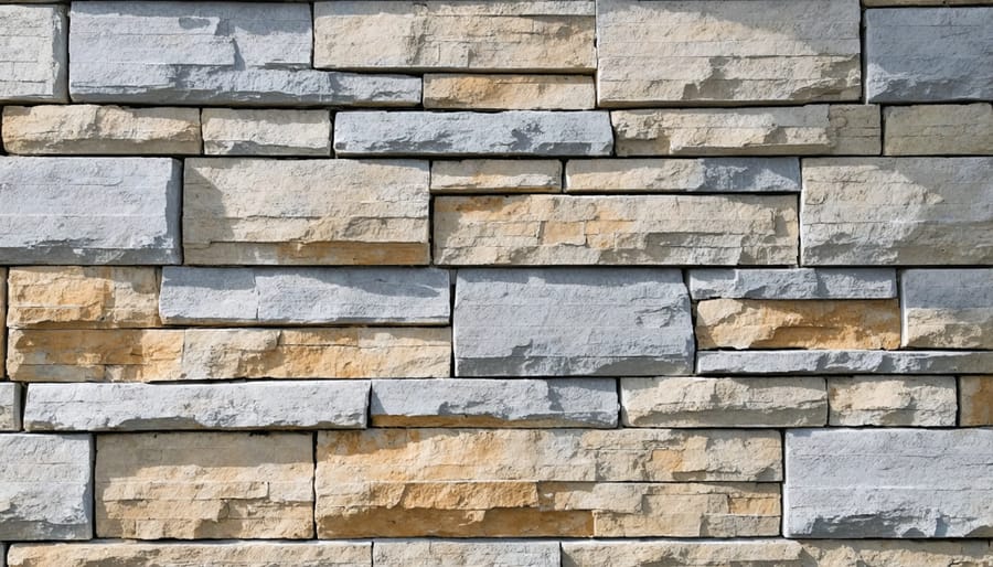
The result is highly accurate 3D digital models that replicate stone surfaces down to millimeter-level detail. The software generates point clouds containing millions of individual measurements, which are then converted into textured mesh models that capture both geometry and color information. These models preserve every crack, vein pattern, and surface irregularity of the natural stone.
Modern photogrammetry platforms can achieve accuracies within 1-2 centimeters for large-scale quarry mapping and sub-centimeter precision for detailed architectural features. This level of detail enables precise volume calculations, pattern matching for stone selection, and accurate measurements for restoration projects without physical contact with delicate or hard-to-reach stone surfaces.
From Traditional Measuring to Digital Precision
For decades, stone fabricators and contractors relied on manual measuring tools to document stone installations and quarry sites. Traditional methods like tape measures provided basic dimensions but were time-consuming and prone to human error, especially across irregular surfaces or large-scale projects. Laser distance meters improved accuracy for linear measurements but still required multiple readings and manual data compilation.
UAV photogrammetry represents a fundamental shift in how the stone industry captures spatial data. Where a traditional site survey might take a full day and yield basic measurements, a drone can capture comprehensive data in under an hour. The resulting 3D models achieve accuracies within 1-2 centimeters, far exceeding what’s possible with manual tools across complex surfaces.
This technology integrates seamlessly with digital design technologies, enabling architects and fabricators to work from precise digital models rather than approximations. Time savings translate directly to reduced labor costs, while improved accuracy minimizes costly material waste from incorrect measurements. For projects involving facade restoration, quarry mapping, or custom stonework, drone photogrammetry eliminates the guesswork that once complicated complex installations.
Real-World Applications for Stone Projects
Stone Facade Assessments and Restoration Planning
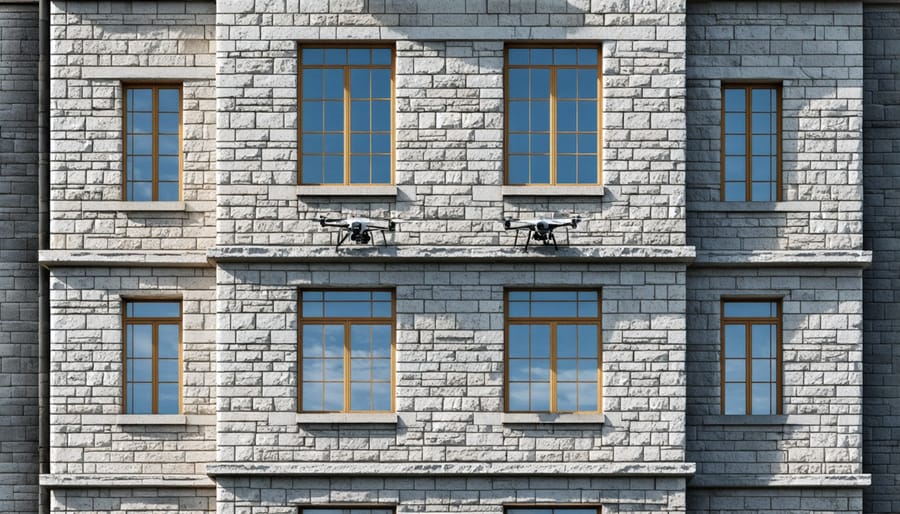
Historic buildings and modern stone-clad structures face a common challenge: assessing facade condition often requires expensive scaffolding, rope access teams, or aerial lifts that pose safety risks and disrupt building operations. UAV photogrammetry has transformed this process by enabling comprehensive facade surveys from a safe distance.
Drones equipped with high-resolution cameras capture thousands of overlapping images of stone facades from multiple angles and distances. These images are processed into detailed 3D models with millimeter-level accuracy, revealing cracks, spalling, deterioration, and weathering patterns that might be invisible from ground level. The technology works seamlessly with AI-powered stone mapping to create comprehensive facade documentation.
For restoration architects and building owners, this approach delivers significant advantages. Survey teams can inspect entire building facades in hours rather than weeks, documenting conditions at heights that would otherwise require costly access equipment. The resulting 3D models allow restoration teams to detect stone damage precisely, quantify deterioration, measure affected areas for material estimates, and plan interventions with unprecedented accuracy.
One notable application involved surveying a 12-story limestone facade where traditional inspection methods were impractical. Drone photogrammetry completed the assessment in two days, identifying specific stones requiring replacement and providing accurate measurements for fabrication. This eliminated guesswork, reduced material waste, and ensured restoration crews arrived on-site with precisely matched replacement stones, cutting project timelines by 30 percent while improving safety outcomes.
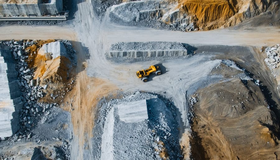
Quarry Mapping and Stone Selection
UAV photogrammetry transforms how quarry operators and stone suppliers showcase their inventory to clients. Drones equipped with high-resolution cameras fly systematic patterns over quarry sites, capturing hundreds of overlapping images that software processes into detailed 3D models. These digital representations allow stakeholders to remotely inspect stone deposits, examine color variations, and assess material quality without visiting the physical location.
The technology calculates accurate volume measurements of stone blocks and deposits, enabling precise inventory management and cost estimation. Quarry managers can track extraction progress over time by comparing periodic drone surveys, identifying exactly how much material remains available. For architects and designers selecting materials for projects, these 3D models provide an unprecedented preview of stone characteristics, including veining patterns, color consistency, and block sizes.
This visualization capability streamlines the selection process significantly. Clients can digitally “walk through” quarry sites, marking preferred blocks and making informed decisions before extraction begins. The approach reduces site visits, accelerates project timelines, and ensures selected materials meet exact specifications, ultimately minimizing waste and costly mistakes during the procurement phase.
Large-Scale Stone Landscaping and Hardscaping
UAV photogrammetry has transformed how professionals approach large-scale stone landscaping and hardscaping projects. By capturing hundreds of aerial images and processing them into detailed 3D terrain models, drones provide unprecedented accuracy for planning outdoor stone features that must integrate seamlessly with existing landscapes.
For stone patios and terraces, photogrammetry reveals subtle elevation changes and drainage patterns that might go unnoticed during traditional surveys. This information helps designers determine optimal placement, calculate precise material quantities, and identify areas requiring additional grading or drainage solutions before installation begins. The result is fewer on-site adjustments and reduced material waste.
Retaining wall projects particularly benefit from this technology. Accurate terrain models show exact grade changes, soil conditions, and erosion patterns across the project area. Engineers can design walls with appropriate heights and reinforcement while contractors receive detailed cut-and-fill calculations, minimizing guesswork and costly overages.
Stone driveway installations require careful consideration of drainage, grade transitions, and base preparation. Photogrammetry-generated models allow contractors to visualize how water will flow across the surface, identify low spots that might collect water, and plan for proper crown or slope. This proactive approach prevents future drainage problems that could compromise the installation.
The technology also excels at documenting existing conditions for outdoor stone features like fire pits, outdoor kitchens, and garden walls. Designers can virtually test different configurations and stone selections within the actual terrain before making final recommendations, giving clients realistic expectations and confidence in the design process.
The Benefits That Matter for Stone Installation Projects
Reduced Material Waste and Cost Savings
Natural stone represents one of the most significant material expenses in high-end construction and landscaping projects, making accuracy in measurement and ordering essential for budget control. UAV photogrammetry dramatically reduces material waste by providing precise volumetric calculations and surface area measurements before stone orders are placed. Traditional estimation methods often result in ordering excess material as a safety buffer, typically 10-15% over calculated needs, leading to substantial waste on expensive materials like granite, marble, and limestone.
Drone-generated 3D models eliminate guesswork by delivering measurements accurate to within centimeters. This precision allows contractors and designers to order exactly what’s needed, reducing over-ordering while maintaining sufficient material for project completion. For a typical residential stone veneer project requiring 500 square feet of material at $30 per square foot, reducing waste from 15% to 3% translates to savings of approximately $1,800 in material costs alone.
The technology also identifies challenging areas during the planning phase, allowing teams to optimize stone cutting patterns and minimize offcuts. When working with premium materials where waste directly impacts the bottom line, these improvements in ordering accuracy can offset the cost of drone surveying within a single project while establishing more predictable budgeting for future work.
Enhanced Safety for Complex Stone Projects
Traditional methods of measuring and documenting stone installations on tall buildings, steep roofs, or challenging terrain often put workers at considerable risk. Scaffolding accidents, falls from ladders, and injuries on unstable surfaces represent significant hazards in the stone industry. UAV photogrammetry fundamentally transforms this safety equation by eliminating the need for workers to access dangerous locations for measurement purposes.
Drones can safely capture detailed images of stone facades on multi-story buildings, rooftop installations, and cliff-side structures without requiring anyone to climb or work at heights. This technology is particularly valuable when assessing existing stone work for restoration projects, where aging structures may pose additional stability concerns. A drone can document deteriorating stone walls, chimneys, or architectural features that would otherwise require risky manual inspection.
For stone contractors and architects, this means fewer liability concerns and reduced insurance costs associated with site access. Workers remain on the ground while the drone collects comprehensive visual data, which can then be processed into accurate 3D models and measurements. This approach has proven especially beneficial for historical stone buildings, where preservation requirements often coincide with challenging access conditions.
Better Project Visualization and Client Communication
UAV photogrammetry transforms how stone contractors and designers communicate project concepts to clients. Traditional 2D blueprints and sketches often leave property owners struggling to envision the final result, leading to uncertainty and mid-project changes. Three-dimensional models generated from drone imagery provide an immersive, photorealistic preview of proposed installations within the actual site context.
Clients can virtually walk around stone veneer facades, retaining walls, or patio designs before a single stone is laid. This visualization capability proves particularly valuable for complex projects like curved staircases or intricate exterior cladding where spatial relationships are difficult to convey through drawings alone. Decision-makers can evaluate stone selection, pattern layouts, and design elements with confidence, significantly reducing the “I thought it would look different” conversations that plague construction projects.
The technology also facilitates collaborative design adjustments. When clients visualize stone installations in accurate 3D environments, they can provide specific feedback about proportions, colors, and placement. Architects and designers can rapidly iterate designs, presenting multiple options for comparison. This collaborative approach streamlines approval processes and ensures all stakeholders share a unified vision before committing resources to fabrication and installation, ultimately saving time and preventing costly misunderstandings.
Real Case Study: Historic Stone Building Restoration
The restoration of the historic Riverside County Courthouse in California demonstrates how UAV photogrammetry revolutionized the approach to preserving century-old stonework. Built in 1903, the courthouse featured an ornate limestone facade that had deteriorated significantly due to weathering, requiring comprehensive restoration while maintaining historical accuracy.
The project team faced immediate challenges. Traditional surveying methods would have required expensive scaffolding around the entire four-story building, and hand measurements couldn’t capture the intricate details of carved cornices, columns, and decorative elements without risk to both workers and the fragile stone surfaces. The project timeline was tight, and budget constraints demanded efficient solutions.
The restoration contractor deployed a commercial-grade UAV equipped with a 45-megapixel camera to conduct photogrammetric surveys. Over two flight sessions totaling just four hours, the team captured more than 800 high-resolution images of the building’s exterior from multiple angles and elevations. Ground control points were established using survey-grade GPS equipment to ensure dimensional accuracy within 5 millimeters.
Processing the imagery through photogrammetry software produced a detailed 3D model containing over 200 million data points. This digital twin revealed damage patterns invisible from ground level, including hairline cracks in upper-story stone panels and deterioration of mortar joints behind decorative elements. The model allowed restoration specialists to precisely measure each stone block, document existing conditions, and identify 47 stones requiring replacement versus 183 needing surface treatment only.
The accuracy proved invaluable during the fabrication phase. Stone suppliers used measurements extracted directly from the 3D model to cut replacement limestone blocks, eliminating the guesswork that typically adds 15-20 percent material waste to heritage projects. Carved decorative elements were replicated using CNC milling guided by the digital model, ensuring perfect dimensional matches to original features.
The project achieved remarkable results. Total survey costs were 60 percent lower than traditional methods would have required, and the entire assessment phase was completed in three weeks instead of an estimated three months. Most significantly, the detailed documentation allowed craftspeople to work more efficiently, reducing overall project duration by five weeks and saving approximately $180,000 in labor and scaffolding costs.
The courthouse restoration demonstrates how UAV photogrammetry transforms complex stone projects from educated guesswork into data-driven precision work, delivering superior outcomes while respecting both budget constraints and irreplaceable historic materials.
What You Need to Know Before Using Drone Photogrammetry
When Does It Make Sense for Your Stone Project?
UAV photogrammetry delivers the greatest value for projects involving large surface areas, complex architectural features, or structures where traditional measuring methods prove challenging or hazardous. Historic building restoration projects benefit significantly, as drones can capture intricate stone facade details without scaffolding or lifts. Quarry operations gain substantial returns through rapid volumetric surveys and inventory management that would take days using ground-based methods.
The technology makes economic sense for custom stone installations exceeding 500 square feet, where precision templating justifies the investment. Commercial projects involving curved walls, domed structures, or multi-story stone cladding see immediate cost savings through reduced site visits and measurement errors. Landscape architects planning extensive hardscape projects with natural stone elements can visualize designs more accurately before material ordering.
However, smaller residential projects under 200 square feet, simple flat installations, or tight interior spaces with limited flying room typically don’t justify the technology investment. Traditional measuring methods remain more practical and cost-effective for straightforward countertop replacements or basic paver installations. Consider drone photogrammetry when project complexity, scale, site accessibility challenges, or safety concerns make conventional approaches less efficient or more expensive.
Working with Professionals Who Offer This Service
When selecting a professional for UAV photogrammetry services in your stone project, start by verifying their credentials and experience. Look for operators who hold Part 107 Remote Pilot Certificates from the Federal Aviation Administration, which ensures they understand aviation regulations and safe flying practices. Ask about their specific experience with stone projects, as working with quarries, stone facades, or construction sites requires specialized knowledge of the material and industry standards.
Request examples of previous stone-related projects, including the level of accuracy achieved and the file formats delivered. Professional services should provide point clouds, 3D models, and orthomosaic images compatible with common design software used by architects and contractors. Inquire about their equipment specifications, as higher-end drones with quality cameras produce more detailed results essential for precise stone measurements and color matching.
Important questions to ask include their turnaround time, data processing capabilities, and whether they carry appropriate insurance coverage for commercial operations. Verify they can deliver the specific outputs your project requires, whether that’s volumetric calculations for quarry inventory, detailed elevation maps for building facades, or 3D models for restoration work.
Consider professionals who demonstrate understanding of both drone technology and natural stone applications. They should communicate clearly about limitations, weather dependencies, and how their services integrate with your project timeline. Request references from previous clients in the stone industry and compare proposals from multiple providers to ensure competitive pricing while maintaining quality standards.
UAV photogrammetry represents a transformative advancement in natural stone project planning and execution, offering unprecedented accuracy, efficiency, and safety benefits that were unimaginable just a decade ago. This technology has evolved from an expensive, specialized tool into an increasingly accessible solution for projects of all scales. As drone technology continues to advance and costs decline, we’re witnessing broader adoption across both commercial developments and high-end residential applications. The ability to capture precise measurements, identify potential challenges before material ordering, and create detailed 3D models has fundamentally changed how stone contractors approach complex installations. Looking ahead, the integration of artificial intelligence and automated processing will further streamline workflows, making UAV photogrammetry a standard practice rather than a luxury service. For property owners, architects, and designers considering natural stone projects—whether a dramatic building facade, intricate landscape feature, or custom outdoor living space—embracing this technology means fewer surprises, reduced waste, and more predictable outcomes. The future of stone craftsmanship lies in combining traditional artisan skills with cutting-edge digital tools, ensuring that every project achieves the highest standards of precision and beauty.